

 Twenty-five years ago I made the decision to move my Lowrance paper graph sonar to the bow of my bassboat. It didn’t make sense to me to have that much money invested in a chart recorder that was out of view once the electric motor was lowered and the fishing began. The first day I tried this was on Irvine Lake in Southern California, where I looked for balls of shad and hungry largemouth bass below.
It surprised me that the sonar was sensitive enough to draw a line on its screen that was clearly my spoon descending to the bottom. Then as I jigged the spoon up and down, the stylus burned a zigzagged line just above the bottom. Clearly if the sonar was powerful enough to detect my small spoon, it would easily show both baitfish and bass. Moving across the flat with my eyes locked on the graph, I spotted a ball of shad and a strong line just above the bottom in 40 feet of water which had to be a decent fish. I dropped my spoon back down, and watched it falling to the bottom on my sonar screen. As it was getting close to the line made by the bass, the line started rising until it intersected with the falling lure, and I was jolted to reality by a hard tug on my rod!
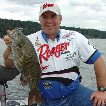
Fish on! I fought the scrappy 3-pound largemouth until I was able to lip it, and then release my prize back to the depths. Looking back at my roll of chart paper at the end of the day I was able to relive the scene, and was even able to see the entire fight on my graph paper.
I have fished with sonar ever since buying one of Lowrance’s “Little Green Box” flashers designed for recreational angling, but never before did I use the sonar to actually spot fish and then catch them!
Today’s sonar units make spotting fish even easier. My Skeeter bassboat has two Lowrance liquid crystal display (LCD) sonar/GPS units at the bow panel and on the console. These high-tech electronic marvels are just what you would expect in an era where “information” rules. Just look at any Sunday newspaper advertisement section and you will see the toys that people crave are electronic. This Information Age is defined by cell phones, notebook computers, MP3 players, and other electronic gadgets. Why should fishing toys be any different?
Today’s high quality and user-friendly sonar units are simple to operate, and they add a new dimension of fun to the fishing experience for recreational anglers.
Electronic advances incorporated into sonar units not only make these tools more effective and packed with bells and whistles, but they also evolved into versatile units that include GPS capability as well. Now you can use your sonar to find a rock pile loaded with bass, punch a button to permanently record its location, and then return to the exact same spot any time you want without having to line up landmarks or use other visual clues.
A few years ago while practicing for a tournament on Kentucky Lake, I experienced a dangerous situation which without the good Lord’s grace and the help of my Lowrance GPS mapping unit, I may not have lived to write about it. Although it was 2 p.m. in the afternoon, a sudden change in weather turned a tranquil, sunny day into my worst nightmare. A tornado had developed, and before my partner and I could get off the lake the twister crossed near us. A bright day had changed to hail, wind, and zero visibility, with us trapped in the main shipping channel of an angry lake.
I couldn’t see 15 feet in front of the boat, and if I looked up the hail stung my face so hard it felt like I was being shot with BB’s. Even though the boat was holding its own against the huge waves, I couldn’t stay in the middle of a major commercial shipping channel and risk getting run over. Likewise, running blindly towards shore was dangerous as Kentucky Lake had rock reefs near shore, especially at each primary point leading into coves that could offer safety. Thank God for my mapping unit and sonar!
By following my boat’s position with relation to where the map showed the shoreline, I was able to maneuver out of the shipping channel, and then locate a cove displayed on the mapping unit. When I got close to the shoreline, I was able to zoom in and make sure I stayed away from the underwater points that were rock reefs at the entrance to the cove. Eventually without being able to physically view where I was going, or where I ended up, I reached the back of a protected cove (tired, cold and wet, but alive and well)!
What I bought thinking would be a “fishing” aid, turned out to be a life-saving tool that I will never again go boating without.
Since that unforgettable day, I have learned that I can trust what the display shows. Now I use my GPS unit to return to offshore structure, fishing honey-holes, and for navigational purposes especially when running in unfamiliar water. Channel buoys are displayed on the highly detailed maps, and the shorelines, mid-channel islands, and points of interest are clearly displayed and named so you will always know where you are and what is around you, regardless of your circumstances. You can locate marinas, fuel, and restaurants with today’s GPS units. My Lowrance X26cHD unit even calculates local tide tables and moon phases. The display will give you lots of other valuable and accurate information, such as your speed, the distance and direction to your destination, and how long it will take you to get there.
One of the shortcomings of early units was the crude display that would make interpretation of sonar signals less meaningful than gazing into a crystal ball. That has changed in a big way. Lowrance makes units with displays that measure up to 10 inches diagonally, and capable of displaying 256 colors. While monochrome units can display as many as 16 shades of gray to help interpretation, color is the rage of today’s top sonar and GPS units. Even a weary angler won’t miss spotting a big bass on the screen when it shows up in brightly contrasting color against the bottom it is hugging. Those familiar with the first color units may have experienced difficult viewing in bright sunlight. That is now a problem of the past as today’s anti-glare units can be viewed in all lighting conditions, and from any angle. When it comes to displaying clear and precise images, it’s all about pixel count! The amount of vertical pixels determines the ability to display an accurate picture of the sonar returns, and fine detail in the GPS maps. A poor quality screen will have a low pixel count, which is incapable of separating a bass sonar return from the bottom signal when it is close to the bottom. With a high pixel count you will see a separation between the bottom and the fish signal, and if you have a color unit it will be even more apparent as the bottom and the fish will show in contrasting colors.
Power is the other feature to compare when choosing a unit. If you only fish in water no deeper than the length of your rod, you may be wasting your money if you buy a powerful unit, which will cost more. But if you want to see baitfish in deep water, or your lure, the more power the better. Modern sonar/GPS units are ready to operate with the factory automatic settings. These are suitable for many, but to take advantage of the high-tech information your unit is capable of producing you need to learn to operate your unit on manual settings in which you adjust the sensitivity, bottom depth, signal clarity, and other settings according to the water conditions. The manual that comes with my Lowrance units explain this in detail, and you can also get helpful information from their website at www.lowrance.com.
So how are you finding your bass, marking your hotspots, and navigating in difficult or treacherous waters? Are you in the “Information Age?” I’m hunting for bass and underwater structure with my sonar and GPS mapping unit. Using this improved electronic marvel is almost as much fun as hooking a bass, and it certainly has helped me to hook more bass! Ciao. You
 Advertising