

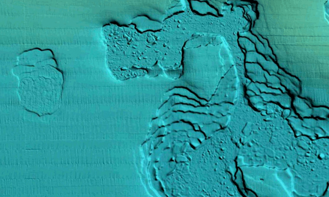

Easily Interpret Bottom Structure
Relief shading delivers highly detailed shading that combines color and shadow to provide an easy-to-interpret, clearer view of bottom structure than contour lines alone.
Identify Topography Quickly
For coastal and inland boat owners who need to know as much as possible about sea and lakes beds, relief shading offers a better understanding of bottom detail for improved fishing and diving.
How to Get Relief Shading
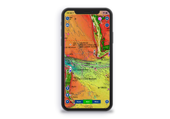
GPS Plotter
Included as a downloadable option with Platinum cards, it can be viewed with compatible models from many brands.
Check compatibility
Already have a Platinum card? With an active subscription, you can download it through the Chart Installer.
The Navionics Subscriptions
When you purchase any new product, a one year subscription to daily updates and many advanced features is included.
GPS Plotter Cards
What you get:
- Download of chart layers
- Daily Updates
- Dock-to-dock Autourouting
- Advanced Map Options
- Plotter Sync
- Relief Shading
Check if your GPS plotter model is compatible with advanced features and make sure it is running the latest software.
Activate your subscription online within 2 months of purchase.
Mobile App
What you get:
- Download of chart layers
- Daily Updates
- Dock-to-dock Autourouting
- Advanced Map Options
- Weather & Tides
- AIS
- GPX Import/Export
- Plotter Sync
- Satellite Overlay with SonarChart™ Shading
- Relief Shading
Subscription expired? After one year, you can purchase a renewal. If you don’t, you can still use your chart layers and download the rest of your coverage area.
The above mentioned advanced features or the download of chart updates require an active subscription.
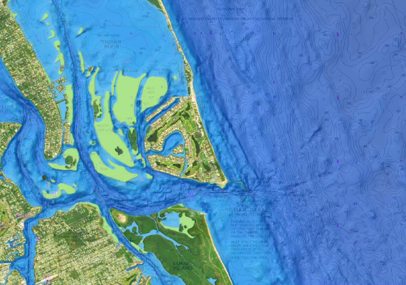
Discover Our Other Overlays
Satellite Overlay
with SonarChart Shading
A combined overlay unveiling hidden features that might hold fish.
 Advertising