

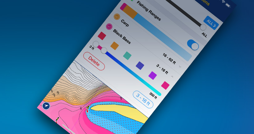
The Fishing Ranges feature allows to customize and display on our SonarChart™ map layer up to 5 depth ranges at the same time! The app interface makes it really intuitive to set: choose a color, select the depth values and name your range: the map will show depth gradients with different color shadings.
A new tool for anglers to quickly and easily locate fishing spots! In our Boating Marine & Lakes app is now possible to customize the chart view with multiple depth ranges simultaneously, for bottom understanding at a glance!
Customize your map
The Fishing Ranges feature allows to customize and display on our SonarChart™ map layer up to 5 depth ranges at the same time! The app interface makes it really intuitive to set: choose a color, select the depth values and name your range: the map will show depth gradients with different color shadings.Easily plan your fishing trip and target the best place to cast the lure
Have a clear view of bottom depths and choose your fishing area depending on the fish you want to catch. Then move quickly on the water telling with a glimpse holes, submerged islands, steep ledges and drop-offs.Go fishing in multicolor!
Want to know more? Get instructions, downloads...Read more at: https://www.navionics.com/usa/blog/post/locate-fishing- spots-at-a-glance-with- multiple-depth-ranges-in-our- boating-app/
 Advertising
Copyright © 2013-2026 WesternBass.com ®