|
Enjoy the best views!
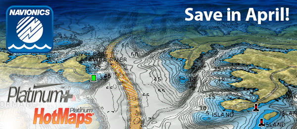
3D View
With 3D View functionality, boaters can manipulate how the chart appears, such as exaggerating features to reveal subtle changes in bottom structure while also rotating charts for better situational awareness.
Satellite Overlay
Satellite overlay embedded on the chart can be displayed over land only, land and shallow water, or in full view. Transparency adjustment is also possible – and gives boaters a better understanding of how the surrounding areas relate to chart features, such as points and bluffs or shallow marsh areas.
Panoramic Pictures
A camera icon indicates where full color panoramic pictures and aerial photos of marinas, harbor approaches, docks and dams are available.
Edwin Evers wins 2016 Bassmaster Classic!
Platinum charts are a great resource for cruising, as well as fishing, all over the world. “I depended on Navionics detailed contours to give me that 29lb. bag to win!” – E. Evers, champion of the world’s hottest bass fishing competition.
|


 Advertising